Saturday, January 2, 2016

Entrance Gate to Golden Gate Park, c.1900


Entrance for Golden Gate Park c1900

___________________________________________________________________
"A cigar stand and ticket office were located at this entrance gate to
the Park, facing the turnaround of the Park & Ocean Railroad line.
Diverse leisure activities were available in the Park, including strolling,
canoeing, swimming and touring museums, exotic gardens and lakes."

Available through our galleries on World Wide Archive

Flick Gallery - Bennett Hall •   Golden Gate Park


Reference:
there were two different lines with confusing names. one was called the "Geary, Park, and Ocean Railroad" which ran in the Richmond District and this one which was called the Park and Ocean Railroad. this ran from this station (which was in the Park on Stanyan between Haight and Waller) cutting the corner of the park through where Kezar Stadium would be, then down H street (Lincoln Way) to 48th avenue where entered the park and passed through to La Playa where it ended at Balboa. The router though the west end of the park is still there as a walking path.


ahndy Actually the Turn-around for the park and ocean line was at Fulton and 5th: www.cablecarmuseum.org/co-geary-st.html

ok Langley's 1890 map (from the David Rumsey Collection) shows a building on the west side of Stanyan at Haight -www.davidrumsey.com/luna/servlet/s/20362k

and here's something else from the market Street Railway blog atwww.streetcar.org/blog/2003/07/streetcars-in-the-sunset-t...


In 1883, the Park and Ocean Railroad established the first viable means of access to this desolate area, building a steam railroad from Haight and Stanyan (where the cable car line from the Ferry Building ended) along H Street (now Lincoln Way) almost to Ocean Beach, then north through the western edge of Golden Gate Park into the outer Richmond District, ending at B (Balboa) Street. This steam route was electrified in 1898, and by 1902 was operated by conventional streetcars.


so, I'd say that our suspicions are correct, and that the car on the left is a Haight Street cable car from downtown

-------------------------------------------------------------------------------------------------

Wikipedia on GGP

History of Golden Gate Park


Image from collection of Bennett Hall / Business Image Group

Monday, December 21, 2015

Fort Point & the Golden Gate


The Golden Gate viewed from above Fort Point
toward the Marin Headlands c. 1890


Original photograph attribute to the studio of Taber - but, who knows who actually shot the image
Hand-tinted restoration by Bennett Hall
___________________________________________________________________________

Fort Point was constructed by the U.S. Army Corps of Engineers between 1853 and 1861 
to prevent entrance of a hostile fleet into San Francisco Bay during the Civil War. 
Between 1933 and 1937 the Fort was used as a base of operations for the 
construction of the Golden Gate Bridge.

Castillo de San Joaquin was the original facility that later became Fort Point.  As with Fort Point,
it was erected to guard the mouth of the Bay from intruders.  On July 1, 1846, a critical event occurred with the timing of the raising of the Stars and Stripes in Monterey and later elsewhere over California, prior to statehood. More to follow on this nuance....

___________________________________________________________________________

From Wikipedia:
"The U.S. Army Corps of Engineers began work on Fort Point in 1853. Plans specified that the lowest tier of artillery be as close as possible to water level so cannonballs could ricochet across the water's surface to hit enemy ships at the water-line.[3] Workers blasted the 90-foot (27 m) cliff down to 15 feet (4.6 m) above sea level. The structure featured seven-foot-thick walls and multi-tiered casemated construction typical of Third System forts. It was sited to defend the maximum amount of harbor area. While there were more than 30 such forts on the East Coast, Fort Point was the only one on the West Coast. In 1854 Inspector General Joseph K. Mansfield declared "this point as the key to the whole Pacific Coast...and it should receive untiring exertions".
A crew of 200, many unemployed miners, labored for eight years on the fort. In 1861, with war looming, the army mounted the fort's first cannon. Colonel Albert Sidney Johnston, commander of the Department of the Pacific, prepared Bay Area defenses and ordered in the first troops to the fort. Kentucky-born Johnston then resigned his commission to join the Confederate Army; he was killed at the Battle of Shiloh in 1862."

Reference


Golden Gate and Fort Point after passing storm
___________________________________________________________________________
Hand-tinted black and white Photography, Bennett Hall, 1980
"This photograph of the bridge was made between passing storms with an 8x10" view camera.  Waves from the heavy surf hit the sea wall causing these spectacular curtains of water, shooting up to 20' into the air. The motion effect is created using a slow shutter speed, about 1/4 second."
___________________________________________________________________________

hand-tinted@Bennett Hall • 2014
Original hand-tinted print: available


SOURCE:  Collection of Bennett Hall / San Francisco Images;  digitally mastered by Business Image Group.  

Articles and stories in this post © Bennett Hall / San Francisco Images / Business Image Group •  PURCHASE: You can acquire copies of these images framed and unframed through our World Wide Archive Web Galleries

Thursday, November 19, 2015

Tour San Francisco from the Air during the Roaring Twenties


Aerial of the San Francisco's developing Southern Waterfront


3rd and 16th and mariposa, viewing up 6th toward Market Street
Central Basin area, viewing toward the future site of USCF and Koret Center &
location of Bayfront park on the right, City Hall and Mount Tamalpais in distance
_________________________________________________________________
from original silver gelatin print, collection of Bennett Hall


Stay tuned - more coming soon...
Other Aerials on Flickr:

Reference on the Pier 70 area

Thursday, November 5, 2015

The Emperor Norton has so decreed that a bridge shall be built...


The Bridge Shall be Built...

The Emperor has so decreed that there shall be a Bridge across our Bay (and, in the future, when said bridge is completed, it shall be named after me, so get over it)
_______________________________________________________________________

WHEREAS, we issued our decree ordering the citizens of San Francisco and Oakland to appropriate funds for the survey of a suspension bridge from Oakland Point via Goat Island; also for a tunnel; and to ascertain which is the best project; and whereas the said citizens have hitherto neglected to notice our said decree; and whereas we are determined our authority shall be fully respected; now, therefore, we do hereby command the arrest by the army of both the Boards of City Fathers if they persist in neglecting our decrees. Given under our royal hand and seal at San Francisco, this 17th day of September, 1872
                  
     –Emperor Norton (c.1818-1880)


Order a print of the Emperor


_______________________________________________________________________


_______________________________________________________________________

The following is decreed and ordered to be carried into execution as soon as convenient:

  1. That a suspension bridge be built from Oakland Point to Goat Island, and then to Telegraph Hill; provided such bridge can be built without injury to the navigable waters of the Bay of San Francisco.
  2. That the Central Pacific Railroad Company be granted franchises to lay down tracks and run cars from Telegraph Hill and along the city front to Mission Bay.
  3. That all deeds by the Washington Government since the establishment of our Empire are hereby decreed null and void unless our Imperial signature is first obtained thereto.
March 1872
Website with the full array of Proclamation by the Emperor: http://www.notfrisco.com/nortoniana/
here is the rest of the story: http://en.wikipedia.org/wiki/Emperor_Norton


link to the campaign:http://www.emperorsbridge.org/introduction/

From the Campaign website:

"But it’s not only Emperor Norton’s connection to the Bay Bridge itself that warrants naming the bridge for him.
The Emperor was a champion of racial and religious unity; an advocate for women’s suffrage; and a defender of the public interest, above all.  

He was known for his kindness. He was both passionate and whimsical. Not least, in asserting his own right to be heard, he stood for the outsider, the dreamer and for the idea that people should be accepted for who they are.

In all of these ways, the Emperor was himself a “bridge” who embodied and heralded the values of tolerance and eccentricity that came to be associated with San Francisco, Oakland and the Bay Area."
_______________________________________________________________________


You can follow today's Emperor here on Facebook:

_______________________________________________________________________

Background The Emperor was England born
 and journeyed to California during the Gold Rush in 1849.  Arriving via South Africa he had initial windfalls from real estate and various ventures until he became penniless via a poorly conceived plan to order the rice market.  Ultimately, his palace was less than palatial as he reigned from a rooming house at 624 Commercial Street was less than salubrious.  Nonetheless,was given a pass wherever he went, given the best seat in the best restaurants of the day with never a bill to be presented.  A general at the Presidio provided his uniform, which as it eventually deteriorated,  the Board of Supervisers pitched in a provided another.

At the time, the Emperor was not alone with respect to the eccentrics of the day.  One street character had dubbed himself George Washington II, adorned in Revolutionary War garb, there was the Money King who celebrated his position as a skin flint, and even a bizarre man who simply went by the title of the Great Unknown.  Were they smoking something back then?  Who know, but the Emperor seems the one who has staid the test of time and with us to this day.

_______________________________________________________________________

Hand-tinted by Bennett Hall, 2015
Order a print of the Emperor
from San Francisco Images


Sunday, December 14, 2014

HAPPY HOLIDAYS! The story of the Tree in Union Square


   Original image collection of the History Room of the Oakland Library, Hand-tinted © Bennett Hall 2015)

Union Square's Christmas Tree c1915-1920
A tradition for over 130 years
Attributed to Emperor Norton

_________________________________________________________________

Since 1880, and every year since, a magnificent tree or a facsimile or creation resembling a tree, has adorned Union Square during the holiday season. This annual tradition has, like many things in the City's history, been credited to Emperor Norton (1818-1880), who it is said, in his normal fashion to such matters, simply decreed that this shall be done.   Norton, the City's great eccentric, has also been noted as the first person to envision bridges across the bay, not to mention he is a man who created his own currency.  Apparently, this was also the first public-space Christmas tree in the country.

   REFERENCE: 
Click here to order a print of the Tree in Union Square

Hand-tinted San Francisco Archive on the Flickr 

______________________________________________
...But is this a Real Tree? 

The tree in this photograph is apparently not be tree, rather it is a work of landscaping artistry that surrounds and adorns the monument, using its structure to create the form of a tree. 

TODAY: For many years the trees cut for the Square were real - however starting in 2011, as no one really wanted the cut tree after the season, the decision was made to shift to an artificial tree.   This Story explains the details of the 17 1/2 ton 86' high creation adorned with 33,000 LED light bulbs.


The Emperor in full regalia

___________________________________________________________

Union Square's name originated from pro-Union rallies held on the eve of the Civil War. Built on what was originally a sand dune, the Square became a public park in 1850.

Learn more about first Emperor and his important decrees

Order a print of the Emperor

(Original image collection of the San Francisco Images, Hand-tinted © Bennett Hall 2014)
_________________________________________________________________

Dewey Monument, Union Square viewing North 

Dewey Monument, Union Square viewing North c1905

Union Square, the center of the City in pioneer days, was deeded for permanent public use on January 3, 1850 during the administration of John White Geary, San Francisco's first mayor and postmaster. The 97-foot Corinthian column is topped by a figure representing Victory.

_____________________________________________________________________

 
Dewey Monument Dedication

Dedication of Dewey Monument, May 14 1903

President Roosevelt dedicated the Monument in Union Square to honor the victory of Admiral George Dewey and the American fleet over Spanish forces at Manila Bay, the Philippines in 1898, during the Spanish-American War. The Monument is also a tribute to the U. S. Navy sailors.

Union Square c1915

Articles and stories in this post are © Bennett Hall / San Francisco Images / Business Image Group

Source: (Tree shot) Oakland History Room, Oakland Public Library, digitally mastered by San Francisco Images / Business Image Group.  You can acquire copies of these images framed and unframed through our World Wide Archive Web Galleries. A portion of all sales will be donated to the History Room to assist them with their work preserving local history and to maintain their collections.

Can you help me date this picture? 


There is a question as to the date of this view - the image below shows details of the cars in from of the St. Francis Hotel -  Do you know a vintage car buff who could advise as to the makes and model / years so I can confirm the date.  If you know- please comment / send me an email. 

__________________________________________________________________


The Emperor also was the first to foresee and ultimate decree that a Bridge should be constructed across the Bay - here is his original declaration on the matter:

WHEREAS, we issued our decree ordering the citizens of San Francisco and Oakland to appropriate funds for the survey of a suspension bridge from Oakland Point via Goat Island; also for a tunnel; and to ascertain which is the best project; and whereas the said citizens have hitherto neglected to notice our said decree; and whereas we are determined our authority shall be fully respected; now, therefore, we do hereby command the arrest by the army of both the Boards of City Fathers if they persist in neglecting our decrees. Given under our royal hand and seal at San Francisco, this 17th day of September, 1872


If you like what you see here and would like to help support local history, please become a member of the Oakland Public Library History Room.(Oakland History Room)

Sunday, July 6, 2014

San Francisco History on Display at Swiss Louis on Pier 39


Main Dining Room • Overlooking marina area, Forbes Island and Golden Gate Bridge

___________________________________________________

Swiss Louis, a long time San Francisco tradition established in North Beach in 1936, chose to showcase its City local roots by installing a collection of San Francisco historical images for their flagship restaurant on Pier 39.  These dramatic vintage views of our City form a key design element of their restaurant's experience, second only to their spectacular floor to ceiling views of the wharf and Golden Gate Bridge. 

Tour Swiss Louis San Francisco History Collection

The collection was curated and produced by
Bennett Hall,  of Business Image Group, drawn from their San Francisco Images archive of local photographs of the Bay Area.  Feature mural-size pieces are printed on canvas, hand-tinted by Hall. Each piece was locally framed by Eco Framing using sustainable U.S. forested and milled frame moulding made from solid walnut.


Swuiis Luis banquet

Banquet Seating
1) Worker on Cables during construction of the Golden Gate Bridge
2) Transamerica Pyramid under construction, 1972


It started more than a half century ago in 1936 when a Swiss Italian immigrant named Louis opened the original Swiss Louis Restaurant in North Beach in San Francisco on Broadway Street.

Over the years, as the popularity of the restaurant grew, so did the need for larger facilities. In 1978, after 42 years on Broadway in North Beach, this popular dining establishment moved to Pier 39 near Fisherman’s Wharf. Today, as in the past, Swiss Louis Restaurant continues to provide diners a cozy and casually elegant dining atmosphere.

The current owner, also from Italy, came to Swiss Louis almost 40 years ago and continues the tradition of serving the finest Italian dishes and the freshest seafood.

Swiss Louis on Pier 39, bar area and lounge

Main Lounge and Bar Area, Swiss Louis on Pier 39
2nd floor - North side facing Golden Gate
_______________________________________


_______________________________________


Articles and stories in this post are © Bennett Hall / San Francisco Images / Business Image Group

PURCHASE: You can acquire copies of these images framed and unframed through our World Wide Archive Web Galleries. A portion of all sales will be donated to the History Room to assist them with their work preserving local history and to maintain their collections.

Monday, June 23, 2014

San Francisco-Oakland Bay Bridge Construction


Bay Bridge, West Tower, c. 1937
____________________________________________________

The Bay Bridge originally accommodated 3 lanes of car traffic for each direction on the upper deck, the lower deck being reserved for trucks, buses, and trains. In 1957, the railroad tracks were removed to allow eastbound traffic on the lower deck and westbound traffic on top.

Designer Charles H. Purcell
Chief engineer was Ralph Modjeski.
Construction began July 9, 1933


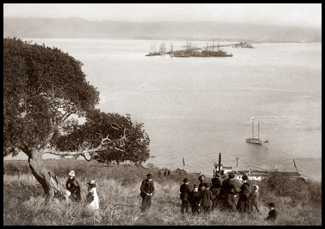
Picnic on Yerba Buena Island 
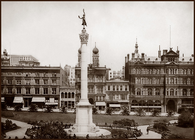
Viewing East toward Long Wharf & Oakland Mole, 1886
___________________________________________________________

First established by the military in 1868, Yerba Buena Island was originally intended for artillery batteries to defend the Bay. It served as a regular Army camp until 1880, when the island was then transferred to the Navy.  Extending into the Bay in the distance are the Long Wharf, used for shipping, and the Oakland Mole (right), which served commuters traveling across the Bay. 

The railroad extended its Oakland wharf to the edge of the deep water in San Francisco Bay to allow larger vessels to connect with its overland trains and to shorten the trip by ferry to the opposite shore. The Long Wharf (on the left) was used for shipping, Oakland Mole pier (right) was used for passengers. The pier extended over 2 miles into the Bay, serving commuters traveling to and from San Francisco and the East Bay.

This 116 acre island later became the mid-point of the Bay Bridge,
which was completed in only three years, opening in November 1936.
___________________________________________________________


The Push to Span the Bay

San Francisco's leaders recognizing that they were on the wrong side of the Transcontinental railroad, realized that to protect their growing economic ambitions that bridging the Bay was not optional - this was a matter of when not if.


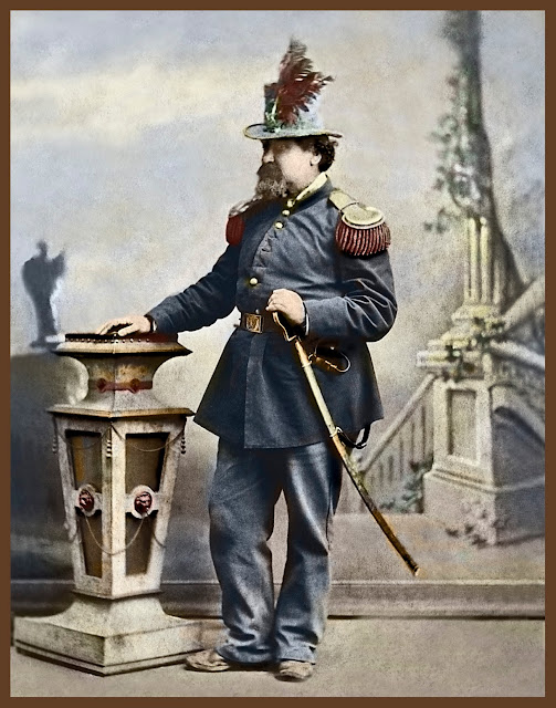
The Emperor has Spoken: 

A Bridge Shall be built...

__________________________________________________________

WHEREAS, we issued our decree ordering the citizens of San Francisco and Oakland to appropriate funds for the survey of a suspension bridge from Oakland Point via Goat Island; also for a tunnel; and to ascertain which is the best project; and whereas the said citizens have hitherto neglected to notice our said decree; and whereas we are determined our authority shall be fully respected; now, therefore, we do hereby command the arrest by the army of both the Boards of City Fathers if they persist in neglecting our decrees. Given under our royal hand and seal at San Francisco, 
this 17th day of September, 1872
                  
     –Emperor Norton

(PS: what was the reason we are not naming this after him again?)
Emperor Norton Bridge Campaign

(this image from collection of San Francisco Images)


 Bay Bridge Tower Construction from Rincon Hill Area c. 1934

Charles M.Hiller, photographer, from the Library of Congress
_________________________________________________


 Bay Bridge Construction from Telegraph Hill, c. 1934

_________________________________________________

 This view over waterfront piers shows one of the four towers of the Bridge
at different stages of construction. Building a bridge across the Bay had been a dream since the days of the Gold Rush often attributed to  Emperor Norton  who in 1872 issued a decree demanding
the construction of the bridge. 

Construction of the Bridge finally commenced in 1933, and was completed only three years later. Timothy L. Pflueger was the chairman of the committee of consulting architects on the
Bay Bridge project.


The crossing from Yerba Buena Island to Oakland was spanned by a 10,176 foot cantilever bridge, the longest bridge of its kind at the time. To enable a shorter path across the Bay, a tunnel was created through the Island - the largest diameter bore tunnel in the world at 76’ wide, 58’ high. The Bridge was completed in 1936, accommodating automobile traffic on the upper deck, and the Key Rail system, buses and trucks on the lower deck.


Workers under the Caisson supporting the San Francisco
Bay Bridge during construction
__________________________________________________________
"Underneath the world's largest caisson, 92' wide by 197', which we will launched today at Moore Dry Docks, Oakland, this section will be christened when a beribboned bottle will be broken over its brow by Mrs. C. H. Purcell, wife of Chief Engineer of the SF Bay Bridge. 

This caisson will be be sunk through mud and clay to bedrock and form the bottom of a concrete and steel structure extending 478.5 feet from the floor of the bay to a point 298.5' above the water midway between SF and Yerba Buena Island"


Installing the Shroud atop of the San Francisco-Oakland Bay Bridge, 1936
__________________________________________________________________

"Installation of "Shroud" on the $77MSF-Oakland Bay Bridge on the center anchorage. 
The shroud will cover eye-bars and "A-Frame" atop this mid-water monolith to which giant cables are attached.  It will soon be filled with concrete for a rigid grip. 6-20-1936"


Workers on North Catwalk
________________________________

Crew securing 100-foot sections of wire-mesh flooring on the cables at
Tower West two • August 17, 1935


Bay Bridge Lighting During Construction, December 1935
___________________________________________________

Chosen for their soft, non-glare illumination, the sodium vapor lamps hung from the
Bay Bridge’s western span suspension cables added a festive quality.
The Bridge was now less than a year from completion,
and would soon enable significant expansion to the East Bay.


East Side of Yerba Buena Island during construction of Cantilever Section • c.1935

_________________________________________________________

 Yerba Buena Island during the construction of the Cantilever section of the Bay Bridge
Two 500-foot anchor arms are started to connect 1400' of double deck bridge just east of Yerba Buena Island.  The western anchor arm, shown at the right, will be completed when it reached Pier E2
in the water just off the island  The 1400-foot cantilever span will not be joined until early 1936 accordingly to Chief Engineer C. H. Purcell


Hoisting the last section of the Cantilever section of the Eastern Span from a barge positioned on the Bay below. This is very nearly the section that collapsed on to its lower deck during the 1989
Loma Prieta Earthquake • c1936

_________________________________________________________


West Tower of Bay Bridge, Under Construction, 1935
___________________________________________________
The West Tower of the Bay Bridge rises 281 feet above the Bay,
with a concrete anchorage sunk 235 feet below the water line. Its
total height is taller than that of the largest of the Pyramids of Egypt
and it contains more concrete than the Empire State Building.

(this image from collection of San Francisco Images)

__________________________________________________


North and South Cables spanning the Anchorage of the Bay Bridge, Photographed October 15, 1935

_________________________________________________________


Opening Day Ceremony, 5th Street Terminus
November 12, 1936
___________________________________________________

5th Street terminus (off ramp) of the Bay Bridge on the day of its ceremonial opening - traffic moved in two direction in the day of c ours with the Key Line system and other rail systems on the lower level. Remember, when the Bay Bridge opened automobile traffic was on the upper deck, moving in two directions, with rail and public transport on the lower deck.

This image shows the elegant original design with a plaza-style experience upon entry or exit from the Bridge.  I hope to find a image of the center point and will post that as soon as I can locate it.

Clyde Sunderland, Photographer, from the Library of Congress


Eye Bolt of the Original Eastern Span

________________________________________________
Hand-Tinted black and white photograph by Bennett Hall ©1980/2014
shot with an 8 x 10 view camera on mobile dolly

________________________________________________

Articles and stories in this post are © Bennett Hall / San Francisco Images / Business Image Group


Emperor Norton Bridge Campaign

________________________________________________

the New Eastern Span construction:  "The Bridge Builders" by Joseph Blum Photography
________________________________________________

Flickr Collection on the Bay Bridge and Treasure Island

Wikipedia on the San Francisco Oakland Bay Bridge

Bancroft Library Digital Archive of Construction

_____________________________________________________________________

Donate to the Oakland History Room at the Oakland Library


SOURCES: Unless otherwise indicated, these images were sourced from the Oakland History Room, Oakland Public Library, and have been digitally mastered by San Francisco Images / Business Image Group.  

PURCHASE: You can acquire copies of these images framed and unframed through our World Wide Archive Web Galleries. A portion of all sales will be donated to the History Room to assist them with their work preserving local history and to maintain their collections.

Sunday, May 25, 2014

In Remembrance ...Returning sailors, new recruits at the enlisting office, Fort Point


Returning Sailors at Hunter’s Point, January 1945
_________________________________________________________

Enlisted men, wounded in battle and home again after many months,
eagerly read American newspapers. This ship, the USS President Hayes,
was an attack transport in 1943 serving the Pacific area, and participated
in the successful invasion of Guam in July 1944 and Leyte in October.


Enlisting in the Marines. Recruiting office. San Francisco, California
_________________________________________________________

photograph by John Collier (1913-1992)
Published: 1941 Dec.


Top of the Mark, Mark Hopkins Hotel
_________________________________________________________

Opened in 1926, the Hotel was named after Mark Hopkins, founder of the Central Pacific Railroad. In 1939, the 19th floor penthouse was converted into a glass-walled lounge offering 360 degree views of the City. WWII servicemen toasted the Golden Gate for luck before shipping out.


Victory Parade, Spanish-American War, c. 1898
_________________________________________________________

At the turn of the century, San Francisco was the jumping-off point for America’s imperialistic adventures 
annexing land in the Pacific. Crowds lined Market Street to celebrate the homecoming of their 
'California Boys' in appreciation of their efforts during this War.


Golden Gate from Above Fort Point, c. 1890
________________________________________________________________

Fort Point was constructed by the U.S. Army Corps of Engineers between 1853 and 1861 to prevent entrance 
of a hostile fleet into San Francisco Bay during the Civil War. Between 1933 and 1937 the Fort was used 
as a base of operations for the construction of the Golden Gate Bridge. 
________________________________________________________________
Hand-tinted by Bennett Hall / 2014